

Sierra de Guadarrama National Park Nature History and Hiking Guide

Less than an hour from Madrid, the Sierra de Guadarrama rises into a different Spain: cooler air, granite ridges, pine forests, high pastures, glacial lakes, and villages built from stone. It feels wild in places, yet it has shaped human movement for centuries. Armies crossed its passes, shepherds used its slopes, and walkers still follow old tracks between valleys.
Declared a National Park in 2013, Sierra de Guadarrama protects one of the most important mountain systems in central Spain. It is both a natural refuge and a human frontier, stretching across the Community of Madrid and Castile and León. For hikers, it offers routes from gentle forest paths to demanding summit walks. For history-minded travellers, it gives a clear view of how geography can steer politics, war, trade, and daily life.
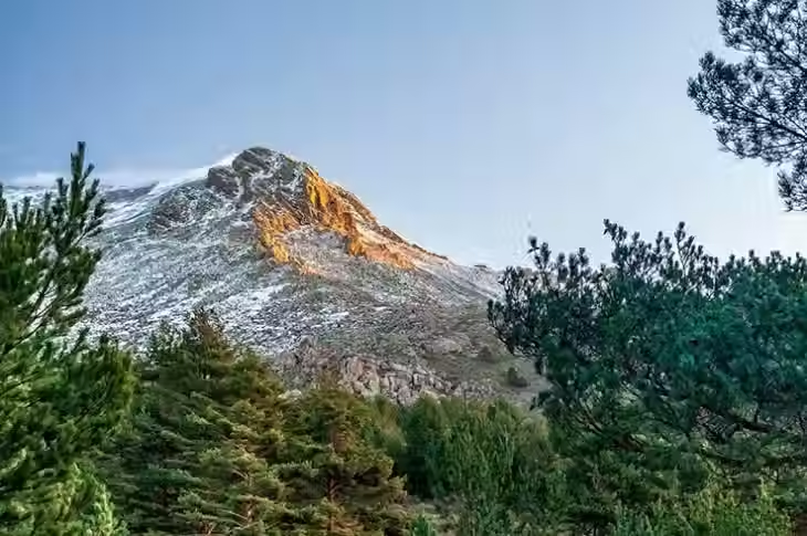
Where Sierra de Guadarrama National Park sits in Spain
The Sierra de Guadarrama forms part of the Sistema Central, the mountain chain that cuts across the centre of the Iberian Peninsula. The park protects the highest and most sensitive areas of the range, including summits, forests, rocky formations, wetlands, and glacial features.
Its location explains much of its appeal. From Madrid, many access points are close enough for a day trip. From Segovia and other towns on the northern side, the mountains appear as a long wall of peaks and passes. That position has made the range a natural boundary for centuries.
The park is not one single trailhead or valley. It is a broad protected area with several distinct entry points, each with a different character.
Area | Best known for | Good for |
Peñalara and Puerto de Cotos | High peaks, glacial lagoons, open mountain views | Summit hikes and alpine scenery |
La Pedriza | Granite formations, rock climbing, river walks | Dramatic geology and shorter hikes |
Valsaín and nearby forests | Mature pinewoods and shaded tracks | Forest walking and wildlife spotting |
Cercedilla and Fuenfría Valley | Historic paths and Roman road remains | Moderate hikes with cultural interest |
Rascafría and Lozoya Valley | Monastery setting, river paths, access to high routes | Mixed nature and heritage days |
For a first visit, choose one area rather than trying to “do” the whole park. Distances look small on a map, but mountain roads, parking limits, and weather can shape the day.
The natural world of the Guadarrama range
Sierra de Guadarrama National Park has a rich variety of habitats because of its altitude, geology, and climate. The lower slopes are different from the high ridges, and a walk can move through several natural zones in a few hours.
Peñalara is the high point of the park
Peñalara is the highest peak in the range, rising to about 2,428 metres. It is one of the park’s most iconic places, not only for its summit views but also for the glacial cirques and small lagoons below it.
The Peñalara area feels more open and alpine than many parts of central Spain. In winter, snow and ice can make the route serious. In spring and early summer, meltwater feeds streams and wetlands. In clear weather, the views stretch across both sides of the mountains.
The glacial lagoons near Peñalara are fragile. Sticking to marked paths matters here because repeated footfall damages vegetation and wet ground. Swimming is not appropriate in protected lagoons, and dogs may face restrictions in sensitive areas.
La Pedriza is a granite world
La Pedriza, near Manzanares el Real, looks unlike almost anywhere else in the park. Huge granite domes, boulders, slabs, and towers fill the valley. Erosion has shaped the stone into forms that invite names and legends.
This area is popular with hikers, climbers, and families, so it can be busy. The reward is immediate drama: rocky paths, clear pools, views towards the Manzanares valley, and the walls of the Santillana reservoir below.
Good walking options in La Pedriza range from gentle riverside routes to rougher loops over granite terrain. The rock can be slippery when wet and exposed when hot, so footwear and water matter even on short walks.

Ancient forests give the park its quieter side
The Guadarrama is not only peaks and bare rock. Its forests are some of its greatest strengths. Scots pine covers large areas, especially around Valsaín and the high valleys. Oaks, holm oaks, junipers, and shrubs appear in lower and drier zones.
These woods support a wide range of wildlife. Visitors may see griffon vultures circling above ridges, smaller birds in the pines, reptiles on warm stones, and signs of mammals along quieter tracks. The Iberian ibex is one of the park’s most visible large animals in some areas, often seen on rocky slopes.
The forests also give hikers shelter from wind and sun. On hot days, a shaded route in the Fuenfría Valley or Valsaín woods can be a better choice than a fully exposed ridge.
The history written into the mountains
The Sierra de Guadarrama has always been more than scenery. Its passes and ridges shaped how people moved between the northern and southern Meseta. That made it important in trade, religion, politics, and war.
During the Middle Ages, the range acted as a natural barrier between territories held by Christian and Muslim powers during the long period often called the Reconquest. Mountain passes were strategic, and control of movement through them mattered. The terrain did not stop contact completely, but it did make travel more limited and easier to monitor.
Later, roads and passes through the mountains stayed important. The Peninsular War brought military movement and conflict to central Spain. In the 20th century, the Spanish Civil War again turned parts of the Guadarrama into contested ground. Trenches, bunkers, and military remains can still be found in some areas, though many are unmarked or need care to interpret properly.
This layered past gives the park a different weight. A ridge path may be a scenic walk, an old livestock route, a military position, and a local boundary all at once.
Old routes still guide modern walks
Some modern hiking paths follow ancient ways of crossing the mountains. The Fuenfría Valley near Cercedilla is a good example. It has long been one of the most important corridors through the range, with traces linked to Roman and later roads.
Walking here feels less remote than Peñalara, but it carries a strong sense of continuity. Forest tracks, stone bridges, old paved sections, and viewpoints show how practical mountain travel once was. These were not leisure paths at first. They were routes for trade, livestock, messengers, soldiers, and local communities.
Villages and monasteries add depth to a visit
The park’s cultural story continues in the villages around it. Rascafría, Manzanares el Real, Cercedilla, and Navacerrada all make useful bases, each with its own rhythm.
Rascafría is closely linked with the Lozoya Valley and the Monastery of Santa María de El Paular, one of the area’s major heritage sites. Manzanares el Real is known for its castle and for access to La Pedriza. Cercedilla has a long mountain tradition and good access to forest walks.
Spending time in these places adds texture to the trip. The national park protects nature, but the mountain culture around it helps explain why this range matters.

Best hiking areas for different kinds of walkers
The park suits different levels of walking experience, but route choice matters. A short forest walk and a high ridge route can have very different risks on the same day.
Choose Peñalara for high mountain views
Peñalara is the classic goal for walkers who want the top of the range. Routes usually begin around Puerto de Cotos, which is one of the most popular access points. The main paths can be straightforward in good summer conditions, but the mountain deserves respect.
Choose this area if you want:
Open views over the Sierra de Guadarrama
A clear summit objective
Glacial features and high-altitude scenery
A route that feels more alpine than forested
Avoid it in poor visibility unless you have mountain navigation skills. Snow, ice, wind, and sudden cloud can change the nature of the walk quickly.
Choose La Pedriza for granite scenery
La Pedriza is ideal for walkers who want distinctive geology. The paths often feel playful, weaving between boulders, slabs, pine trees, and streams. It also works well for shorter outings, though longer routes can be rough underfoot.
Choose this area if you want:
Dramatic rocks and natural forms
A wide choice of route lengths
Access from Manzanares el Real
Good options outside deep winter
In summer, start early. Granite reflects heat, shade can be patchy, and water sources should not be relied on.
Choose Cercedilla and Fuenfría for history and forest
The Fuenfría Valley offers one of the best blends of nature and culture. Paths climb through pinewoods towards passes and viewpoints, with historic route sections along the way. This area is a strong choice for moderate walkers and anyone interested in old mountain crossings.
Choose this area if you want:
Shaded trails
Historic paths
Good public transport options compared with more remote areas
Routes that can be adapted by distance and effort
The walking here may feel gentler than Peñalara, but fog, snow, and ice can still affect higher sections.
Choose Rascafría and Lozoya for a rounded day
Rascafría and the Lozoya Valley work well for travellers who want walking, village time, and heritage in the same trip. River paths and forest routes can be combined with visits to nearby cultural sites.
Choose this area if you want:
A less rushed day
Access to both high routes and easier valley walks
Mountain views without committing to a summit
A village base with food and accommodation options
A practical hiking guide for planning well
The Guadarrama is accessible, but it is still a mountain environment. Good planning keeps the day enjoyable and helps protect the park.
When to visit
Each season changes the experience.
Season | What to expect | Best for |
Spring | Snow may remain high up, streams run stronger, flowers appear | Forest walks and lower routes |
Summer | Hot lower slopes, busy weekends, clear early starts | High routes if started early |
Autumn | Cooler days, changing colours, often excellent walking | Most routes in stable weather |
Winter | Snow and ice on high ground, shorter days | Experienced walkers with proper kit |
Autumn is often the easiest season for mixed hiking. Summer can be rewarding, but heat and crowds need planning. Winter can be beautiful, especially around snowy pines and peaks, but some routes become mountaineering terrain rather than simple walks.
What to pack
For a day walk, carry more than you think you need. Conditions change with altitude.
Useful basics include:
Walking shoes or boots with good grip
Water, especially in summer
Food and snacks
Warm layer and waterproof jacket
Sun cream, sunglasses, and hat
Map or offline route on a reliable device
Charged phone and spare power if using it for navigation
Small first aid kit
Head torch if walking late in the day
On winter routes, add proper cold-weather gear. For snowy or icy high ground, walkers may need specialist equipment and the skills to use it.
Getting there and managing access
Many visitors arrive from Madrid by car, especially for La Pedriza, Rascafría, and more scattered trailheads. Some access points can also be reached by public transport, including areas such as Cercedilla and Cotos, depending on current services.
Parking can fill early at popular entrances, and some areas may have regulated access at busy times. Check current park rules before travelling, especially for La Pedriza and Peñalara.
A simple rule works well: start early, choose one area, and leave room in the day for slower mountain travel.
How to hike responsibly in Sierra de Guadarrama
The park’s popularity is both a strength and a pressure. Paths near famous sites receive heavy use, and fragile areas need care.
Follow these habits:
Stay on marked paths in sensitive zones
Take all litter home, including food scraps
Do not swim in protected lagoons
Keep noise low near wildlife
Respect seasonal closures and local signs
Use public transport where practical
Give livestock and wildlife plenty of space
Fire risk is serious in central Spain, especially in dry months. Avoid anything that could spark a fire. Do not light fires, and take care with cigarettes, stoves, and glass.
Respect also applies to history. Military remains, old walls, and archaeological features should be left untouched. Photograph them, read about them, but do not move stones or take objects.

A simple first-time itinerary
For a first visit, build the day around one clear focus.
A strong nature and history day could look like this:
Morning in Cercedilla or Cotos
Start early and choose either a forest walk in the Fuenfría Valley or a high route near Peñalara, depending on fitness and weather.
Midday picnic or village lunch
Keep the plan flexible. If the weather worsens, shorten the route and spend more time in a nearby village.
Afternoon heritage stop
Visit Rascafría, Manzanares el Real, or another mountain town. Add a castle, monastery, viewpoint, or short riverside walk.
Return before dark
Mountain roads and paths are easier when there is no rush. Leave a margin rather than squeezing in one more viewpoint.
For a second visit, explore the contrast. If the first day was Peñalara, choose La Pedriza next time. If the first day was granite and heat, return for pine forests and high passes.
The lasting appeal of the Guadarrama
Sierra de Guadarrama rewards slow attention. At first glance, it is a beautiful mountain park near a capital city. Spend longer there, and more layers appear: granite shaped by weather, lagoons left by ice, forests shaped by altitude, paths formed by centuries of movement, and ridges that once held strategic power.
That mix gives the park its character. It is not just a place to summit a peak or take a scenic photograph. It is a range where nature and history sit close together, often on the same path.
Plan lightly but carefully. Choose the right area for the season, respect the protected spaces, and leave time for the villages at the foot of the mountains. The best Guadarrama days are not rushed. They build from cool morning air to wide views, then settle into the long human story of the range.


Comments